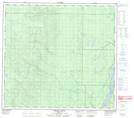
Maps showing Oakley Lake, 6,7,8-100-10-W4, Alberta
Oakley Lake is a Lake located in 6,7,8-100-10-W4, Alberta.
- Latitude: 57° 39' 32'' North (decimal: 57.6588889)
- Longitude: 111° 37' 19'' West (decimal: -111.6219443)
- Topography Feature Category: Lake
- Geographical Feature: Lake
- Canadian Province/Territory: Alberta
- Location: 6,7,8-100-10-W4
- Atlas of Canada Locator Map: Oakley Lake
- GPS Coordinate Locator Map: Oakley Lake Lat/Long
Oakley Lake NTS Map Sheets