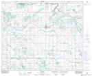
Maps showing Jack Fish Lake, 20-53-9-W4, Alberta
Jack Fish Lake is a Lake located in 20-53-9-W4, Alberta.
- Latitude: 53° 35' 42'' North (decimal: 53.5950000)
- Longitude: 111° 17' 51'' West (decimal: -111.2975000)
- Topography Feature Category: Lake
- Geographical Feature: Lake
- Canadian Province/Territory: Alberta
- Location: 20-53-9-W4
- Atlas of Canada Locator Map: Jack Fish Lake
- GPS Coordinate Locator Map: Jack Fish Lake Lat/Long