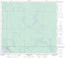
Maps showing East Jackpine Creek, 28-94-9-W4, Alberta
East Jackpine Creek is a River located in 28-94-9-W4, Alberta and has an elevation of 317 meters.
- Latitude: 57° 11' 38'' North (decimal: 57.1938889)
- Longitude: 111° 23' 37'' West (decimal: -111.3936111)
- Topography Feature Category: River
- Geographical Feature: Creek
- Canadian Province/Territory: Alberta
- Elevation: 317 meters
- Location: 28-94-9-W4
- Atlas of Canada Locator Map: East Jackpine Creek
- GPS Coordinate Locator Map: East Jackpine Creek Lat/Long
East Jackpine Creek NTS Map Sheets