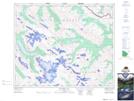
Maps showing Poacher Basin, W5, Alberta
Poacher Basin is a Valley located in W5, Alberta.
- Latitude: 52° 31' 40'' North (decimal: 52.5277777)
- Longitude: 117° 5' 58'' West (decimal: -117.0994443)
- Topography Feature Category: Valley
- Geographical Feature: Basin
- Canadian Province/Territory: Alberta
- Location: W5
- Atlas of Canada Locator Map: Poacher Basin
- GPS Coordinate Locator Map: Poacher Basin Lat/Long
Poacher Basin NTS Map Sheets