Maps showing Trapper Pass, Alberta
Trapper Pass is a Valley located in Alberta.
- Latitude: 52° 37' 21'' North (decimal: 52.6225000)
- Longitude: 117° 39' 14'' West (decimal: -117.6538888)
- Topography Feature Category: Valley
- Geographical Feature: Pass
- Canadian Province/Territory: Alberta
- Atlas of Canada Locator Map: Trapper Pass
- GPS Coordinate Locator Map: Trapper Pass Lat/Long
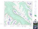
Trapper Pass NTS Map Sheets