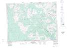
Maps showing Improvement District No. 4, 2-30-W4, Alberta
Improvement District No. 4 is a Other municipal/district area - miscellaneous located in 2-30-W4, Alberta.
- Latitude: 49° 5' 13'' North (decimal: 49.0868999)
- Longitude: 113° 53' 45'' West (decimal: -113.8958000)
- Topography Feature Category: Other municipal/district area - miscellaneous
- Geographical Feature: Improvement District
- Canadian Province/Territory: Alberta
- Location: 2-30-W4
- Atlas of Canada Locator Map: Improvement District No. 4
- GPS Coordinate Locator Map: Improvement District No. 4 Lat/Long
Improvement District No. 4 NTS Map Sheets