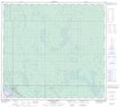
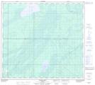
Maps showing Shelley Creek, 33-95-9-W4, Alberta
Shelley Creek is a River located in 33-95-9-W4, Alberta.
- Latitude: 57° 17' 10'' North (decimal: 57.2861111)
- Longitude: 111° 24' 45'' West (decimal: -111.4124999)
- Topography Feature Category: River
- Geographical Feature: Creek
- Canadian Province/Territory: Alberta
- Location: 33-95-9-W4
- Atlas of Canada Locator Map: Shelley Creek
- GPS Coordinate Locator Map: Shelley Creek Lat/Long
Shelley Creek NTS Map Sheets