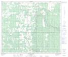
Maps showing Dog Eating Prairie, 24-67-22-W5, Alberta
Dog Eating Prairie is a Beach located in 24-67-22-W5, Alberta.
- Latitude: 54° 48' 27'' North (decimal: 54.8074999)
- Longitude: 117° 13' 51'' West (decimal: -117.2308332)
- Topography Feature Category: Beach
- Geographical Feature: Flat
- Canadian Province/Territory: Alberta
- Location: 24-67-22-W5
- Atlas of Canada Locator Map: Dog Eating Prairie
- GPS Coordinate Locator Map: Dog Eating Prairie Lat/Long
Dog Eating Prairie NTS Map Sheets