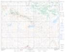
Maps showing Big Gap, 28-37-7-W4, Alberta
Big Gap is a Valley located in 28-37-7-W4, Alberta.
- Latitude: 52° 12' 58'' North (decimal: 52.2161110)
- Longitude: 110° 56' 43'' West (decimal: -110.9452777)
- Topography Feature Category: Valley
- Geographical Feature: Gap
- Canadian Province/Territory: Alberta
- Location: 28-37-7-W4
- Atlas of Canada Locator Map: Big Gap
- GPS Coordinate Locator Map: Big Gap Lat/Long
Big Gap NTS Map Sheets