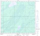
Maps showing Khahago Creek, 36-95-9-W4, Alberta
Khahago Creek is a River located in 36-95-9-W4, Alberta.
- Latitude: 57° 17' 00'' North (decimal: 57.2833333)
- Longitude: 111° 18' 50'' West (decimal: -111.3138889)
- Topography Feature Category: River
- Geographical Feature: Creek
- Canadian Province/Territory: Alberta
- Location: 36-95-9-W4
- Atlas of Canada Locator Map: Khahago Creek
- GPS Coordinate Locator Map: Khahago Creek Lat/Long
Khahago Creek NTS Map Sheets