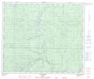
Maps showing Jackfish Lake, 25-66-27-W5, Alberta
Jackfish Lake is a Lake located in 25-66-27-W5, Alberta.
- Latitude: 54° 44' 37'' North (decimal: 54.7436111)
- Longitude: 117° 56' 20'' West (decimal: -117.9388889)
- Topography Feature Category: Lake
- Geographical Feature: Lake
- Canadian Province/Territory: Alberta
- Location: 25-66-27-W5
- Atlas of Canada Locator Map: Jackfish Lake
- GPS Coordinate Locator Map: Jackfish Lake Lat/Long
Jackfish Lake NTS Map Sheets