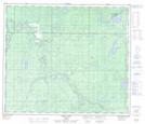
Maps showing Stony Woman Creek, 23-68-26-W5, Alberta
Stony Woman Creek is a River located in 23-68-26-W5, Alberta.
- Latitude: 54° 53' 54'' North (decimal: 54.8983333)
- Longitude: 117° 51' 6'' West (decimal: -117.8516666)
- Topography Feature Category: River
- Geographical Feature: Creek
- Canadian Province/Territory: Alberta
- Location: 23-68-26-W5
- Atlas of Canada Locator Map: Stony Woman Creek
- GPS Coordinate Locator Map: Stony Woman Creek Lat/Long
Stony Woman Creek NTS Map Sheets