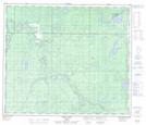
Maps showing Bridle Bit Creek, 32-68-25-W5, Alberta
Bridle Bit Creek is a River located in 32-68-25-W5, Alberta.
- Latitude: 54° 55' 26'' North (decimal: 54.9238889)
- Longitude: 117° 46' 14'' West (decimal: -117.7705555)
- Topography Feature Category: River
- Geographical Feature: Creek
- Canadian Province/Territory: Alberta
- Location: 32-68-25-W5
- Atlas of Canada Locator Map: Bridle Bit Creek
- GPS Coordinate Locator Map: Bridle Bit Creek Lat/Long
Bridle Bit Creek NTS Map Sheets