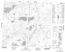
Maps showing Dead Calf Lake, 12-90-21-W4, Alberta
Dead Calf Lake is a Lake located in 12-90-21-W4, Alberta.
- Latitude: 56° 47' 12'' North (decimal: 56.7866666)
- Longitude: 113° 12' 55'' West (decimal: -113.2152777)
- Topography Feature Category: Lake
- Geographical Feature: Lake
- Canadian Province/Territory: Alberta
- Location: 12-90-21-W4
- Atlas of Canada Locator Map: Dead Calf Lake
- GPS Coordinate Locator Map: Dead Calf Lake Lat/Long
Dead Calf Lake NTS Map Sheets