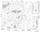
Maps showing Rod Creek, 26-91-21-W4, Alberta
Rod Creek is a River located in 26-91-21-W4, Alberta.
- Latitude: 56° 55' 6'' North (decimal: 56.9183333)
- Longitude: 113° 16' 20'' West (decimal: -113.2722221)
- Topography Feature Category: River
- Geographical Feature: Creek
- Canadian Province/Territory: Alberta
- Location: 26-91-21-W4
- Atlas of Canada Locator Map: Rod Creek
- GPS Coordinate Locator Map: Rod Creek Lat/Long
Rod Creek NTS Map Sheets