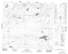
Maps showing Whistwow Lake, 20-89-22-W4, Alberta
Whistwow Lake is a Lake located in 20-89-22-W4, Alberta.
- Latitude: 56° 43' 48'' North (decimal: 56.7300000)
- Longitude: 113° 28' 15'' West (decimal: -113.4708333)
- Topography Feature Category: Lake
- Geographical Feature: Lake
- Canadian Province/Territory: Alberta
- Location: 20-89-22-W4
- Atlas of Canada Locator Map: Whistwow Lake
- GPS Coordinate Locator Map: Whistwow Lake Lat/Long
Whistwow Lake NTS Map Sheets