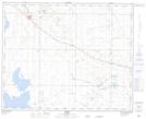
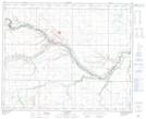
Maps showing Frenchman's Creek, 1-39-12-W4, Alberta
Frenchman's Creek is a River located in 1-39-12-W4, Alberta.
- Latitude: 52° 19' 40'' North (decimal: 52.3277778)
- Longitude: 111° 35' 51'' West (decimal: -111.5974999)
- Topography Feature Category: River
- Geographical Feature: Creek
- Canadian Province/Territory: Alberta
- Location: 1-39-12-W4
- Atlas of Canada Locator Map: Frenchman's Creek
- GPS Coordinate Locator Map: Frenchman's Creek Lat/Long
Frenchman's Creek NTS Map Sheets