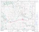
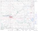
Maps showing Indian Lake, 9-51-7-W4, Alberta
Indian Lake is a Lake located in 9-51-7-W4, Alberta.
- Latitude: 53° 23' 36'' North (decimal: 53.3933333)
- Longitude: 110° 59' 19'' West (decimal: -110.9886111)
- Topography Feature Category: Lake
- Geographical Feature: Lake
- Canadian Province/Territory: Alberta
- Location: 9-51-7-W4
- Atlas of Canada Locator Map: Indian Lake
- GPS Coordinate Locator Map: Indian Lake Lat/Long
Indian Lake NTS Map Sheets