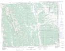
Maps showing Iron Lakes, 1-15-4-W5, Alberta
Iron Lakes is a Lake located in 1-15-4-W5, Alberta.
- Latitude: 50° 14' 1'' North (decimal: 50.2336110)
- Longitude: 114° 25' 47'' West (decimal: -114.4297221)
- Topography Feature Category: Lake
- Geographical Feature: Lakes
- Canadian Province/Territory: Alberta
- Location: 1-15-4-W5
- Atlas of Canada Locator Map: Iron Lakes
- GPS Coordinate Locator Map: Iron Lakes Lat/Long
Iron Lakes NTS Map Sheets