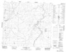
Maps showing Fighting Creek, 34-87-23-W4, Alberta
Fighting Creek is a Lake located in 34-87-23-W4, Alberta.
- Latitude: 56° 35' 9'' North (decimal: 56.5858333)
- Longitude: 113° 35' 46'' West (decimal: -113.5961110)
- Topography Feature Category: Lake
- Geographical Feature: Lake
- Canadian Province/Territory: Alberta
- Location: 34-87-23-W4
- Atlas of Canada Locator Map: Fighting Creek
- GPS Coordinate Locator Map: Fighting Creek Lat/Long
Fighting Creek NTS Map Sheets