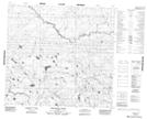
Maps showing Stoney Lake, 13-99-2-W4, Alberta
Stoney Lake is a Lake located in 13-99-2-W4, Alberta.
- Latitude: 57° 35' 33'' North (decimal: 57.5924999)
- Longitude: 113° 18' 34'' West (decimal: -113.3094443)
- Topography Feature Category: Lake
- Geographical Feature: Lake
- Canadian Province/Territory: Alberta
- Location: 13-99-2-W4
- Atlas of Canada Locator Map: Stoney Lake
- GPS Coordinate Locator Map: Stoney Lake Lat/Long
Stoney Lake NTS Map Sheets