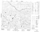
Maps showing Antler Lake, 32-98-21-W4, Alberta
Antler Lake is a Lake located in 32-98-21-W4, Alberta.
- Latitude: 57° 32' 56'' North (decimal: 57.5488889)
- Longitude: 113° 22' 40'' West (decimal: -113.3777778)
- Topography Feature Category: Lake
- Geographical Feature: Lake
- Canadian Province/Territory: Alberta
- Location: 32-98-21-W4
- Atlas of Canada Locator Map: Antler Lake
- GPS Coordinate Locator Map: Antler Lake Lat/Long
Antler Lake NTS Map Sheets