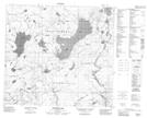
Maps showing Pelican Island, 35,36-97-16-W4, Alberta
Pelican Island is a Island located in 35,36-97-16-W4, Alberta.
- Latitude: 57° 27' 23'' North (decimal: 57.4563889)
- Longitude: 112° 37' 58'' West (decimal: -112.6327777)
- Topography Feature Category: Island
- Geographical Feature: Island
- Canadian Province/Territory: Alberta
- Location: 35,36-97-16-W4
- Atlas of Canada Locator Map: Pelican Island
- GPS Coordinate Locator Map: Pelican Island Lat/Long
Pelican Island NTS Map Sheets