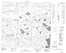
Maps showing Big Island, 27-99-16-W4, Alberta
Big Island is a Island located in 27-99-16-W4, Alberta.
- Latitude: 57° 36' 56'' North (decimal: 57.6155555)
- Longitude: 112° 32' 13'' West (decimal: -112.5369443)
- Topography Feature Category: Island
- Geographical Feature: Island
- Canadian Province/Territory: Alberta
- Location: 27-99-16-W4
- Atlas of Canada Locator Map: Big Island
- GPS Coordinate Locator Map: Big Island Lat/Long
Big Island NTS Map Sheets