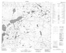
Maps showing The "Y", 18-99-15-W4, Alberta
The "Y" is a River located in 18-99-15-W4, Alberta.
- Latitude: 57° 35' 26'' North (decimal: 57.5905555)
- Longitude: 112° 27' 43'' West (decimal: -112.4619444)
- Topography Feature Category: River
- Geographical Feature: River
- Canadian Province/Territory: Alberta
- Location: 18-99-15-W4
- Atlas of Canada Locator Map: The "Y"
- GPS Coordinate Locator Map: The "Y" Lat/Long
The "Y" NTS Map Sheets