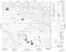
Maps showing Test Lake, 15-97-3-W4, Alberta
Test Lake is a Lake located in 15-97-3-W4, Alberta.
- Latitude: 57° 25' 1'' North (decimal: 57.4169444)
- Longitude: 110° 24' 15'' West (decimal: -110.4041666)
- Topography Feature Category: Lake
- Geographical Feature: Lake
- Canadian Province/Territory: Alberta
- Location: 15-97-3-W4
- Atlas of Canada Locator Map: Test Lake
- GPS Coordinate Locator Map: Test Lake Lat/Long
Test Lake NTS Map Sheets