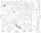
Maps showing Boundary Creek, 4-97-1-W4, Alberta
Boundary Creek is a River located in 4-97-1-W4, Alberta.
- Latitude: 57° 23' 1'' North (decimal: 57.3836111)
- Longitude: 110° 5' 44'' West (decimal: -110.0955555)
- Topography Feature Category: River
- Geographical Feature: Creek
- Canadian Province/Territory: Alberta
- Location: 4-97-1-W4
- Atlas of Canada Locator Map: Boundary Creek
- GPS Coordinate Locator Map: Boundary Creek Lat/Long
Boundary Creek NTS Map Sheets