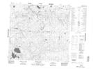
Maps showing Little Island Lake, 24-95-25-W4, Alberta
Little Island Lake is a Lake located in 24-95-25-W4, Alberta.
- Latitude: 57° 15' 34'' North (decimal: 57.2594444)
- Longitude: 113° 55' 4'' West (decimal: -113.9177778)
- Topography Feature Category: Lake
- Geographical Feature: Lake
- Canadian Province/Territory: Alberta
- Location: 24-95-25-W4
- Atlas of Canada Locator Map: Little Island Lake
- GPS Coordinate Locator Map: Little Island Lake Lat/Long
Little Island Lake NTS Map Sheets