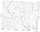
Maps showing Aguhway Lake, 21,22-91-23-W4, Alberta
Aguhway Lake is a Lake located in 21,22-91-23-W4, Alberta.
- Latitude: 56° 54' 17'' North (decimal: 56.9047222)
- Longitude: 113° 37' 41'' West (decimal: -113.6280556)
- Topography Feature Category: Lake
- Geographical Feature: Lake
- Canadian Province/Territory: Alberta
- Location: 21,22-91-23-W4
- Atlas of Canada Locator Map: Aguhway Lake
- GPS Coordinate Locator Map: Aguhway Lake Lat/Long
Aguhway Lake NTS Map Sheets