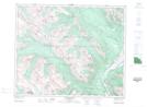
Maps showing Monarch Meadows, 15,16-46-3 W6, Alberta
Monarch Meadows is a Plain located in 15,16-46-3 W6, Alberta and has an elevation of 1946 meters.
- Latitude: 53° 0' 30'' North (decimal: 53.0083333)
- Longitude: 118° 24' 40'' West (decimal: -118.4111111)
- Topography Feature Category: Plain
- Geographical Feature: Flats
- Canadian Province/Territory: Alberta
- Elevation: 1946 meters
- Location: 15,16-46-3 W6
- Atlas of Canada Locator Map: Monarch Meadows
- GPS Coordinate Locator Map: Monarch Meadows Lat/Long
Monarch Meadows NTS Map Sheets