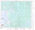
Maps showing Square Creek, 15-69-13-W4, Alberta
Square Creek is a River located in 15-69-13-W4, Alberta.
- Latitude: 54° 58' 26'' North (decimal: 54.9738888)
- Longitude: 111° 54' 30'' West (decimal: -111.9083333)
- Topography Feature Category: River
- Geographical Feature: Creek
- Canadian Province/Territory: Alberta
- Location: 15-69-13-W4
- Atlas of Canada Locator Map: Square Creek
- GPS Coordinate Locator Map: Square Creek Lat/Long
Square Creek NTS Map Sheets