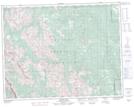
Maps showing Nash Meadow, 33,34-19-5-W5, Alberta
Nash Meadow is a Low vegetation located in 33,34-19-5-W5, Alberta.
- Latitude: 50° 38' 53'' North (decimal: 50.6480555)
- Longitude: 114° 37' 53'' West (decimal: -114.6313889)
- Topography Feature Category: Low vegetation
- Geographical Feature: Meadow
- Canadian Province/Territory: Alberta
- Location: 33,34-19-5-W5
- Atlas of Canada Locator Map: Nash Meadow
- GPS Coordinate Locator Map: Nash Meadow Lat/Long
Nash Meadow NTS Map Sheets