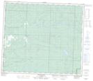
Maps showing Jackfish Lake, 14-76-11-W6, Alberta
Jackfish Lake is a Lake located in 14-76-11-W6, Alberta and has an elevation of 823 meters.
- Latitude: 55° 34' 37'' North (decimal: 55.5769444)
- Longitude: 119° 35' 56'' West (decimal: -119.5988889)
- Topography Feature Category: Lake
- Geographical Feature: Lake
- Canadian Province/Territory: Alberta
- Elevation: 823 meters
- Location: 14-76-11-W6
- Atlas of Canada Locator Map: Jackfish Lake
- GPS Coordinate Locator Map: Jackfish Lake Lat/Long
Jackfish Lake NTS Map Sheets