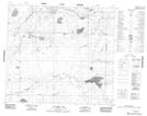
Maps showing Baseline Lake, 35-89-17-W4, Alberta
Baseline Lake is a Lake located in 35-89-17-W4, Alberta.
- Latitude: 56° 40' 48'' North (decimal: 56.6799999)
- Longitude: 113° 14' 3'' West (decimal: -113.2341666)
- Topography Feature Category: Lake
- Geographical Feature: Lake
- Canadian Province/Territory: Alberta
- Location: 35-89-17-W4
- Atlas of Canada Locator Map: Baseline Lake
- GPS Coordinate Locator Map: Baseline Lake Lat/Long
Baseline Lake NTS Map Sheets