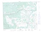
Maps showing Gastle Creek, 7-34-4-W5, Alberta
Gastle Creek is a River located in 7-34-4-W5, Alberta.
- Latitude: 51° 54' 20'' North (decimal: 51.9055555)
- Longitude: 114° 33' 4'' West (decimal: -114.5511110)
- Topography Feature Category: River
- Geographical Feature: Creek
- Canadian Province/Territory: Alberta
- Location: 7-34-4-W5
- Atlas of Canada Locator Map: Gastle Creek
- GPS Coordinate Locator Map: Gastle Creek Lat/Long