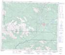
Maps showing Hells Creek Rapids, 29-57-8-W6, Alberta
Hells Creek Rapids is a Rapids located in 29-57-8-W6, Alberta.
- Latitude: 53° 57' 4'' North (decimal: 53.9511111)
- Longitude: 119° 9' 16'' West (decimal: -119.1544444)
- Topography Feature Category: Rapids
- Geographical Feature: Rapids
- Canadian Province/Territory: Alberta
- Location: 29-57-8-W6
- Atlas of Canada Locator Map: Hells Creek Rapids
- GPS Coordinate Locator Map: Hells Creek Rapids Lat/Long
Hells Creek Rapids NTS Map Sheets