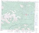
Maps showing Sulphur Gates, 19-56-8-W6, Alberta
Sulphur Gates is a River feature located in 19-56-8-W6, Alberta.
- Latitude: 53° 50' 58'' North (decimal: 53.8494444)
- Longitude: 119° 10' 55'' West (decimal: -119.1819443)
- Topography Feature Category: River feature
- Geographical Feature: Confluence
- Canadian Province/Territory: Alberta
- Location: 19-56-8-W6
- Atlas of Canada Locator Map: Sulphur Gates
- GPS Coordinate Locator Map: Sulphur Gates Lat/Long
Sulphur Gates NTS Map Sheets