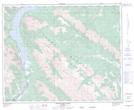
Maps showing Ex Coelis Mountain, 27-35-16,21-W5, Alberta
Ex Coelis Mountain is a Mountain located in 27-35-16,21-W5, Alberta.
- Latitude: 52° 1' 54'' North (decimal: 52.0316667)
- Longitude: 116° 20' 26'' West (decimal: -116.3405556)
- Topography Feature Category: Mountain
- Geographical Feature: Mountain
- Canadian Province/Territory: Alberta
- Location: 27-35-16,21-W5
- Atlas of Canada Locator Map: Ex Coelis Mountain
- GPS Coordinate Locator Map: Ex Coelis Mountain Lat/Long
Ex Coelis Mountain NTS Map Sheets