Maps showing King Edward Glacier, Alberta
King Edward Glacier is a Glacier located in Alberta.
- Latitude: 52° 9' 54'' North (decimal: 52.1649999)
- Longitude: 117° 30' 48'' West (decimal: -117.5133333)
- Topography Feature Category: Glacier
- Geographical Feature: Glacier
- Canadian Province/Territory: Alberta
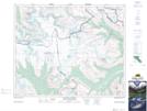
- Atlas of Canada Locator Map: King Edward Glacier
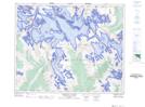
- GPS Coordinate Locator Map: King Edward Glacier Lat/Long
King Edward Glacier NTS Map Sheets