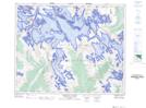
Maps showing Ontario Glacier, Alberta
Ontario Glacier is a Glacier located in Alberta.
- Latitude: 52° 9' 6'' North (decimal: 52.1516666)
- Longitude: 117° 32' 44'' West (decimal: -117.5455556)
- Topography Feature Category: Glacier
- Geographical Feature: Glacier
- Canadian Province/Territory: Alberta
- Atlas of Canada Locator Map: Ontario Glacier
- GPS Coordinate Locator Map: Ontario Glacier Lat/Long
Ontario Glacier NTS Map Sheets