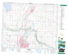
Maps showing Hazelett Lake, E1/2-5-39-27-4, Alberta
Hazelett Lake is a Lake located in E1/2-5-39-27-4, Alberta.
- Latitude: 52° 19' 20'' North (decimal: 52.3222000)
- Longitude: 113° 50' 35'' West (decimal: -113.8431000)
- Topography Feature Category: Lake
- Geographical Feature: Lake
- Canadian Province/Territory: Alberta
- Location: E1/2-5-39-27-4
- Atlas of Canada Locator Map: Hazelett Lake
- GPS Coordinate Locator Map: Hazelett Lake Lat/Long