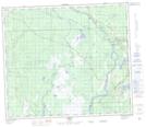
Maps showing Improvement District No. 124, Alberta
Improvement District No. 124 is a Other municipal/district area - miscellaneous located in Alberta.
- Latitude: 55° 13' 43'' North (decimal: 55.2285999)
- Longitude: 114° 20' 5'' West (decimal: -114.3346999)
- Topography Feature Category: Other municipal/district area - miscellaneous
- Geographical Feature: Improvement District
- Canadian Province/Territory: Alberta
- GPS Coordinate Locator Map: Improvement District No. 124 Lat/Long
Improvement District No. 124 NTS Map Sheets