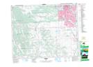
Maps showing Brown-Lowery Provincial Park, 21-4-W5, Alberta
Brown-Lowery Provincial Park is a Conservation area located in 21-4-W5, Alberta.
- Latitude: 50° 48' 50'' North (decimal: 50.8138999)
- Longitude: 114° 25' 50'' West (decimal: -114.4305999)
- Topography Feature Category: Conservation area
- Geographical Feature: Provincial Park
- Canadian Province/Territory: Alberta
- Location: 21-4-W5
- Atlas of Canada Locator Map: Brown-Lowery Provincial Park
- GPS Coordinate Locator Map: Brown-Lowery Provincial Park Lat/Long
Brown-Lowery Provincial Park NTS Map Sheets