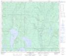
Maps showing Improvement District No. 18, Alberta
Improvement District No. 18 is a Other municipal/district area - miscellaneous located in Alberta.
- Latitude: 54° 53' 35'' North (decimal: 54.8930999)
- Longitude: 111° 13' 29'' West (decimal: -111.2246999)
- Topography Feature Category: Other municipal/district area - miscellaneous
- Geographical Feature: Improvement District
- Canadian Province/Territory: Alberta
- GPS Coordinate Locator Map: Improvement District No. 18 Lat/Long
Improvement District No. 18 NTS Map Sheets