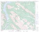
Maps showing Normandy Peak, 35-17-5W, Alberta
Normandy Peak is a Mountain located in 35-17-5W, Alberta.
- Latitude: 52° 2' 47'' North (decimal: 52.0463888)
- Longitude: 116° 20' 48'' West (decimal: -116.3466666)
- Topography Feature Category: Mountain
- Geographical Feature: Peak
- Canadian Province/Territory: Alberta
- Location: 35-17-5W
- Atlas of Canada Locator Map: Normandy Peak
- GPS Coordinate Locator Map: Normandy Peak Lat/Long
Normandy Peak NTS Map Sheets