Maps showing Vulcan County, 17-22-W4, Alberta
Vulcan County is a Major municipal/district area - major agglomeration located in 17-22-W4, Alberta.
- Latitude: 50° 24' 44'' North (decimal: 50.4122222)
- Longitude: 113° 0' 0'' West (decimal: -113.0000000)
- Topography Feature Category: Major municipal/district area - major agglomeration
- Geographical Feature: Municipal District
- Canadian Province/Territory: Alberta
- Location: 17-22-W4
- Atlas of Canada Locator Map: Vulcan County
- GPS Coordinate Locator Map: Vulcan County Lat/Long
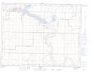
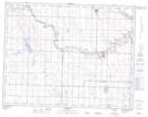
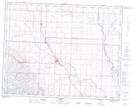
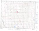
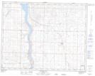
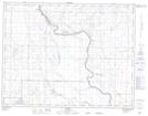
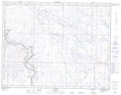
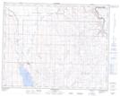
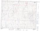
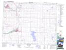
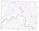
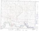
Vulcan County NTS Map Sheets
082I02 Travers Topographic Map at 1:50,000 scale
082I03 Carmangay Topographic Map at 1:50,000 scale
082I05 Nanton Topographic Map at 1:50,000 scale
082I06 Vulcan Topographic Map at 1:50,000 scale
082I07 Mcgregor Lake Topographic Map at 1:50,000 scale
082I08 Scandia Topographic Map at 1:50,000 scale
082I09 Cassils Topographic Map at 1:50,000 scale
082I10 Queenstown Topographic Map at 1:50,000 scale
082I11 Arrowwood Topographic Map at 1:50,000 scale
082I12 High River Topographic Map at 1:50,000 scale
082I14 Gleichen Topographic Map at 1:50,000 scale
082I15 Cluny Topographic Map at 1:50,000 scale
082I Gleichen Topographic Map at 1:250,000 scale