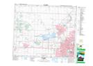
Maps showing Sheffield Industrial, Alberta
Sheffield Industrial is a Unincorporated area located in Alberta.
- Latitude: 53° 33' 38'' North (decimal: 53.5605555)
- Longitude: 113° 35' 45'' West (decimal: -113.5958333)
- Topography Feature Category: Unincorporated area
- Geographical Feature: Urban Community
- Canadian Province/Territory: Alberta
- Atlas of Canada Locator Map: Sheffield Industrial
- GPS Coordinate Locator Map: Sheffield Industrial Lat/Long