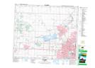
Maps showing Forest Lawn, Alberta
Forest Lawn is a Unincorporated area located in Alberta and has an elevation of 685 meters.
- Latitude: 53° 38' 5'' North (decimal: 53.6347222)
- Longitude: 113° 36' 15'' West (decimal: -113.6041666)
- Topography Feature Category: Unincorporated area
- Geographical Feature: Urban Community
- Canadian Province/Territory: Alberta
- Elevation: 685 meters
- Atlas of Canada Locator Map: Forest Lawn
- GPS Coordinate Locator Map: Forest Lawn Lat/Long