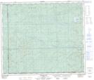
Maps showing First Creek, 33-64-12-W5, Alberta
First Creek is a River located in 33-64-12-W5, Alberta.
- Latitude: 54° 34' 39'' North (decimal: 54.5774999)
- Longitude: 115° 45' 41'' West (decimal: -115.7613889)
- Topography Feature Category: River
- Geographical Feature: Creek
- Canadian Province/Territory: Alberta
- Location: 33-64-12-W5
- Atlas of Canada Locator Map: First Creek
- GPS Coordinate Locator Map: First Creek Lat/Long
First Creek NTS Map Sheets