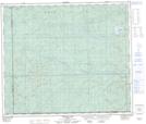
Maps showing Layla Creek, 9-65-2-W5, Alberta
Layla Creek is a River located in 9-65-2-W5, Alberta.
- Latitude: 54° 36' 10'' North (decimal: 54.6027777)
- Longitude: 115° 44' 29'' West (decimal: -115.7413888)
- Topography Feature Category: River
- Geographical Feature: Creek
- Canadian Province/Territory: Alberta
- Location: 9-65-2-W5
- Atlas of Canada Locator Map: Layla Creek
- GPS Coordinate Locator Map: Layla Creek Lat/Long
Layla Creek NTS Map Sheets